Montreal streets map
You can find on this page the Montreal streets map to print and to download in PDF. The Montreal roads map presents the road network, main roads, routes and motorways of Montreal in Quebec - Canada.
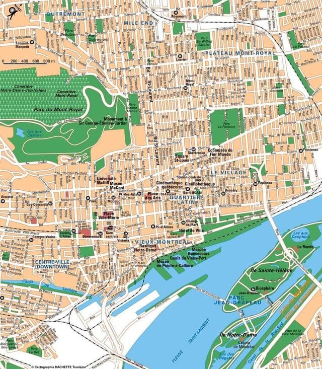
Montreal streets map
The Montreal streets map shows all street network and main roads of Montreal. This streets map of Montreal will allow you to find your routes through the streets of Montreal in Quebec - Canada. The Montreal streets map is downloadable in PDF, printable and free.
Since Montreal is on an island, the directions used in the city plan do not precisely correspond with compass directions, as they are oriented to the geography of the island. North and south are defined on an axis roughly perpendicular to the St. Lawrence River and the Rivière des Prairies: North is towards the Rivière des Prairies, and south is towards the St. Lawrence. East (downstream) and west (upstream) directions are defined as roughly parallel to the St. Lawrence River and the Rivière des Prairies, despite the fact that both rivers flow from the southwest to the northeast. Saint Lawrence Boulevard as you can see in Montreal streets map, also known as “The Main,” divides Montreal into east and west sectors. Streets that cut across Saint Laurent Boulevard undergo a name change, in that Est or Ouest are appended to their names. In the past, a number of streets had both English and French names, such as “avenue du Parc” or “Park Avenue”, “rue de la Montagne” or “Mountain Street”, “rue Saint-Jacques” or “Saint James Street”. Some of these names are still in common colloquial use in English, and perpetuated by the tourism industry. Many streets incorporate an English specific name into French, such as “chemin Queen Mary”, “rue University”, “avenue McGill College”.
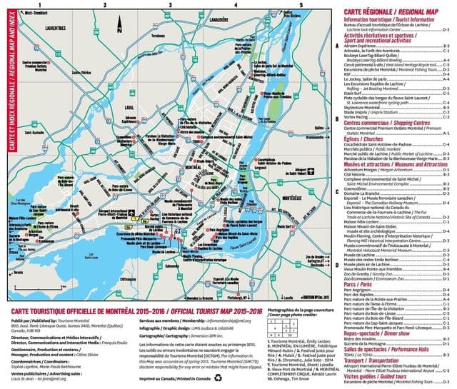
Montreal roads map
The Montreal roads map shows all road network and highways of Montreal. This roads map of Montreal will allow you to find your routes through the roads and motorways of Montreal in Quebec - Canada. The Montreal roads map is downloadable in PDF, printable and free.
Like many major cities, Montreal has a problem with vehicular traffic congestion, especially from off-island suburbs such as Laval on Île Jésus, and Longueuil on the south shore. The width of the Saint Lawrence River has made the construction of fixed links to the south shore expensive and difficult. There are only four road bridges along with one road tunnel, two railway bridges, and a metro line. The far narrower Rivière des Prairies, separating Montreal from Laval, is spanned by eight road bridges (six to Laval and two directly to the north shore). There are only four road bridges along with one road tunnel, two railway bridges, and a metro line as you can see in Montreal roads map. The far narrower Rivière des Prairies, separating Montreal from Laval, is spanned by eight road bridges (six to Laval and two directly to the north shore) and a metro line.